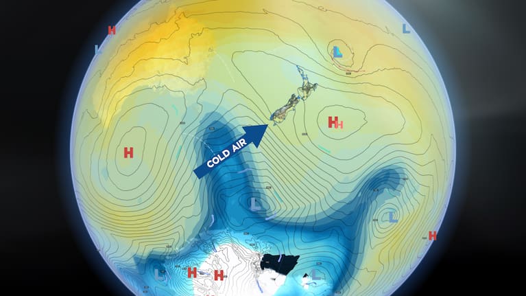
1News meteorologist Daniel Corbett says the El Niño which brought us a hot Summer is fading further into the distance and some proper cold weather is just over the horizon.
The peak conditions in the ocean and atmosphere caused by El Niño have gone off the boil, but there is still a lot of flavour in the atmosphere from it.
It’s a bit like cooking a hot and spicy meal in the kitchen one night and it still has the smell around in the morning.
The big characteristics of El Niño were how it changed the position of our summertime highs due to the changes in warming and cooling of the atmosphere and Pacific Ocean.
The El Niño highs were much bigger and the central core (axis) of them tracked more across the northern half of the country. This compares to a more southerly track with a La Niña.
With more of the country under the meat of the highs, there was plenty of fine weather to go around.
The prevailing winds tended to be more westerly across the country around the bottom of the high, so as a result some western areas had higher amounts of rain and many eastern areas dried out.
Are we now seeing a move to a La Niña?
There has already been lots of talk about the shift from El Niño to the other end of the oscillation scale – La Niña.
Curiously, seasonal forecasts tend to have the lowest accuracy during the Southern Hemisphere Autumn and La Niña, if it transpires, would tend to have the greatest effect on our weather later in the calendar year through the Summer.
To say we might have another wet Summer in parts of the country is way too early. Every La Niña behaves differently. Just like El Niños do.
The next several months across New Zealand will most likely bring us a mix of everything due to the different factors that will affect our weather.
The residual warmth in the oceans and atmosphere from the fading El Niño will be with us, but the biggest factor in the driving seat of our weather heading into late Autumn and Winter is Old Man Winter and his Polar Vortex.
What is the Polar Vortex, and when is it coming?
Think of the Polar Vortex like Old Man Winter’s store cupboard of cold air.
It wobbles like a slow-moving lump of jelly on a plate in the atmosphere over Antarctica. The long nights, and even total darkness, in the frozen south keep daily sunlight away allowing the vortex to grow soon after the Equinox.

It is already in full form and is primed to surge northwards when the time and conditions are right.
Many don’t realise that it is the contrast of warm and cold that makes weather. The temperature contrast boundary is a gradient which creates wind and lift to create clouds, rain, etc.
Remember our leftover warmth from the fading El Niño, add in a healthy surge of good honest cold from Old Man Winter’s store cupboard and that could be the making of some active weather systems.
The first good cold surges into the south of the country are incoming as we finish off April and head into early May. They will increase in frequency and the passing highs in between will gradually track further north and become slightly smaller as we head further into Winter.
That means more wind and rain days, and fewer fine days. Hmmm!
Typical Late Autumn into Winter conditions.
Time to get that firewood ready!


